it seems that i have two things to map: physical and virtual; language and the internet exist in both of these realms. (when i speak of language, i will limit it to large, concentrated communities that share a common language and overlook small language pockets.) language is generally grounded to physical/geographic regions; it also virtually connects people acoss great distances. the internet is exactly the same....grounded in the physical world by existing in the virtual world. as such, i would like to map the physical condition of the internet and language. (see keyframes 1 below). i would then like to morph the map from he 2d geographic world to a 3d language archipelago and abandons geography to illustrate the interconnection of countries based on the language and the internet. (see keyframe 2).
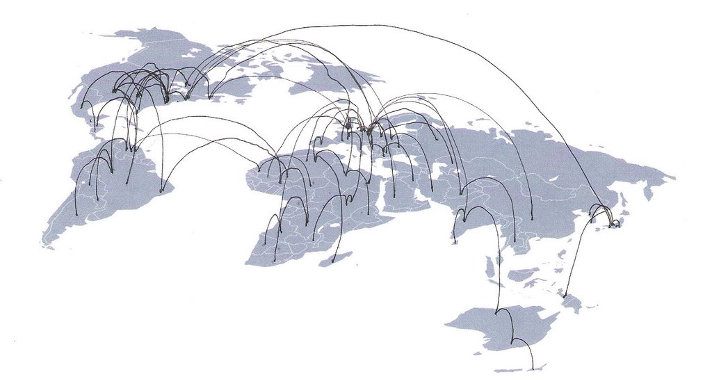
keyframe01: as in earlier drafts, traceroues are geolocated and mapped to show internet infrastructure. topography will be added to indicate router location. color will be added to show language groups.

keyframe02: the countries will morph to this orientation. the image shown is a prototype. each red sphere represents a country. in the final, the size of the sphere will represent the population of the country. the lines represent language connections. in the final, i hope to make these lines have less visual impact so that i can map internet hopping back to the origin.
click the image below to see a quicktime vr of the language archipelago:


No comments:
Post a Comment